Recommended Free Tools
A five-day Big Bend and Nature Coast road trip can take you from Tallahassee and St. Marks National Wildlife Refuge to St. George Island, Cedar Key, Crystal River, and Homosassa. Seven days allows more time for wildlife viewing, beach stops, paddling, and weather delays. The route is flexible: only its northern portion follows the Big Bend Scenic Byway; the stops farther south are coastal extensions.
Begin with marshes, tidal creeks, refuge roads, and birding habitats, then follow the Gulf coast toward the beaches and springs. Wildlife sightings are never guaranteed, so leave room to travel slowly and respond to current conditions.
The route at a glance
Tallahassee → St. Marks National Wildlife Refuge → Wakulla and Panacea → Carrabelle → Apalachicola → St. George Island → Cedar Key → Lower Suwannee National Wildlife Refuge → Crystal River Preserve State Park → Homosassa
This is a flexible corridor, not a promise that every traveler should drive every mile in one direction. The Big Bend Scenic Byway covers the northern segment through Leon, Wakulla, and Franklin counties and Apalachicola National Forest. Cedar Key, Lower Suwannee, Crystal River, and Homosassa extend the trip south along the Gulf coast; they are not part of one continuous official byway. Together, the stops show changing landscapes: freshwater and brackish marshes, pine flatwoods, estuaries, barrier-island beaches, tidal rivers, springs, and managed wildlife habitats.
Do these 3 things before closing this tab:
1Fix the driver behind crashes, sound loss and screen glitches2Repair Windows errors before they cause bigger problems3Scan for outdated or missing drivers - takes under a minute#1 Best Overall

- Bright, high-resolution 5” glass capacitive touchscreen display lets you easily view your route
- Get more situational awareness with alerts for school zones, speed changes, sharp curves and more
- View food, fuel and rest areas along your active route, and see upcoming cities and milestones
- View Tripadvisor traveler ratings for top-rated restaurants, hotels and attractions to help you make the most of road trips
- Directory of U.S. national parks simplifies navigation to entrances, visitor centers and landmarks within the parks
| Stop | Wildlife and travel focus | Suggested pace |
|---|---|---|
| St. Marks National Wildlife Refuge | Refuge roads, marshes, ponds, lighthouse, and birding | One full day |
| Wakulla, Panacea, and the coastal byway | Forest, marsh, bay views, and possible small-boat access | Half to one day |
| Carrabelle, Apalachicola, and St. George Island | Coastal communities, food and history, beach, and bird-watching | One to two days |
| Cedar Key and Lower Suwannee | Quiet estuary, refuge roads and trails, birding, and boating | One full day |
| Crystal River and Homosassa | Springs, marshes, seasonal manatee viewing, and conservation education | One to two days |
When to take this Florida road trip
Fall and winter are a reasonable default for a wildlife-centered itinerary; St. Marks National Wildlife Refuge says hiking is most pleasant in fall, winter, and early spring. Summer can still work well for beaches and paddling, but expect heat, insects, and frequent storms in the Big Bend. Build in flexibility for weather and changing conditions.
Wildlife sightings are unpredictable. A refuge may provide good habitat without producing the particular bird, mammal, or reptile you hoped to see. Take time to stop, scan, and wait rather than treating the route as a checklist of guaranteed sightings.
Florida state parks are generally open from 8 a.m. until sunset, but individual park hours, fees, reservations, tours, closures, and overnight facilities vary. Check the individual state-park page before departure because fees and access details can change.
Day 1: Begin at St. Marks National Wildlife Refuge
St. Marks is a fitting opening stop because it establishes the trip’s wildlife focus before the beach portion. Drive Lighthouse Road slowly, stop at suitable overlooks and ponds, and walk only where current access allows. Continue toward the historic St. Marks Lighthouse if roads are open.
Free tools Windows power users keep installed
One-click scans. No signup required.
The refuge is open during daylight hours, and the Lighthouse Road gate opens at 6 a.m. Roads and levees may close for prescribed burns or wildlife-management needs, so check the official St. Marks visitor information before setting out. Confirm current visitor-center arrangements and any fees directly with the refuge rather than relying on older listings.
At St. Marks, stay on designated roads, trails, and viewing areas. The refuge prohibits feeding or disturbing wildlife, collecting natural features, flying drones, and swimming. Give animals space and use patience and a long lens instead of approaching them.
How to spend the day
- Start early. Give yourself time to drive slowly and stop without rushing.
- Choose a few overlooks and ponds. Scan patiently instead of making constant quick stops.
- Continue toward the lighthouse. Treat the road itself as part of the wildlife experience.
- Check for closures and follow refuge rules. Management needs and wildlife protection take priority over a planned route.
Day 2: Wakulla, Panacea, and the coastal byway
After St. Marks, the trip shifts from a focused refuge visit to a coastal drive. The refuge’s Wakulla Unit includes upland forests, palm hammocks, freshwater and brackish marshes, and tidal access toward Apalachee Bay. The Panacea Unit includes Otter Lake Recreation Area and small-boat launching opportunities.
Rank #2

- 【Map Updates】 This car GPS comes pre-installed with the complete 2026 North America maps and supports free lifetime updates. If you need maps for Europe or other regions, please contact us to download.
- 【Smart Voice Alerts】 This GPS navigation system provides clear turn-by-turn voice guidance, and also alerts you to speed limits and school zones, helping you drive more safely.
- 【Custom Truck Routing】 Supports multiple modes including Car, Truck, Bus, RV, Bicycle, and Pedestrian. In Truck/RV mode, the system automatically avoids low bridges, weight-restricted roads, and narrow lanes.
Do not overload this day with every possible roadside stop. A better rhythm is a wildlife-focused morning, a waterside lunch or town stop, and an afternoon drive toward Carrabelle. Watch the scenery transition from pine flatwoods to marsh, fishing communities, and open bay views.
Windows Errors? Fix Them Before They Spread
Repair common Windows errors and clear accumulated junk for a smoother, more stable PC - no reinstall needed.Free scan · no reinstallCrashes, No Sound, or Screen Glitches?
Random freezes, missing sound and display glitches usually trace back to one bad driver. Find and replace yours safely.Free scan · under a minuteBefore planning a launch, hike, or photography stop, consult the refuge’s current unit and access information. Rules and access can vary by unit and change with management activity or weather.
Day 3: Carrabelle, Apalachicola, and St. George Island
Carrabelle and Apalachicola provide a human and historical contrast to the refuge landscapes. Slow down for a meal or town stop before crossing toward St. George Island.
Dr. Julian G. Bruce St. George Island State Park offers a barrier-island beach interval with swimming, paddling, fishing, hiking, bird-watching, nature study, and stargazing. Keep clear of nesting areas, follow posted signs, and take all trash with you. The park’s beach guidance explains how litter can harm wildlife.
The park listing gives day-use hours as 8 a.m. to sunset and a $6 vehicle fee. It reports the campground closed for renovations effective July 13, 2026. Confirm current fees and overnight arrangements on the park page before travel.
Make St. George Island the midpoint, not necessarily the finale
The open beach makes St. George Island a natural-feeling high point, but it works well as a midpoint. After days spent looking into marshes and tidal creeks, the beach changes the scale of the trip. The quieter coastal habitats farther south then bring the journey back to wildlife.
Day 4: Cedar Key and Lower Suwannee National Wildlife Refuge
Cedar Key and Lower Suwannee offer a quiet estuary and back-road experience suited to birding, hiking, boating, and photography. Carry water and insect repellent, fill the vehicle in a main town, and download maps in advance. Cell service may be unreliable, and refuge access can change.
Rank #3

- 6” high-resolution navigator includes map updates of North America
- Hands-free calling when paired with your compatible smartphone with BLUETOOTH technology and convenient Garmin voice assist lets you ask for directions to places you want to go
- Road trip–ready features include the HISTORY database of notable sites, a U.S. national parks directory, Tripadvisor traveler ratings and millions of Foursquare POIs
- Driver alerts for things such as school zones, sharp curves and speed changes help encourage safer driving and increase situational awareness
- Access live traffic, fuel prices, parking, weather and smart notifications when you pair this navigator with your compatible smartphone running the Garmin Drive app
Choose one access area rather than trying to cover the entire refuge. Check gates, hunting notices, road conditions, and current access on the Lower Suwannee visitor page. Use a printed Florida road atlas as a backup to offline maps, not as a substitute for current refuge notices.
A good Lower Suwannee rhythm
- Choose one access area instead of trying to cover the entire refuge.
- Drive slowly and stop at habitat edges to look for wildlife.
- Use formal trails and keep navigation simple.
- Allow extra time for photography, fishing, or a boat or kayak launch if conditions and current rules permit.
- Check access rules before setting out and do not assume the refuge permits overnight parking or camping.
Day 5: Crystal River Preserve State Park and Homosassa
Crystal River Preserve State Park offers a final shift in habitat, with tidal marsh, hardwood hammock, swamp, and pine flatwoods. Choose a walk, paddle, or permitted boat experience according to weather, conditions, and current access. Check the park’s current experiences and amenities before committing to a launch or tour.
What’s actually slowing this PC down?
Pick the symptom - the matching free tool is one click away.
Crystal River also offers seasonal manatee viewing. The U.S. Fish and Wildlife Service lists the refuge’s manatee season as November 15 through March 31. Three Sisters Springs provides land access by shuttle and boardwalk, but not water access from that property. For water access, use a permitted local business and check current rules and conditions on the Crystal River National Wildlife Refuge visitor information.
Homosassa provides a managed educational wildlife experience. At Ellie Schiller Homosassa Springs Wildlife State Park, visitors can use the paved trail and elevated boardwalks, visit the wildlife walk, take boat transportation along Pepper Creek, and view fish and manatees from an underwater observatory. This differs from seeing wild animals in refuge habitat: some animals at the park are rehabilitating or non-releasable and are part of an educational setting.
Should you bring a dog?
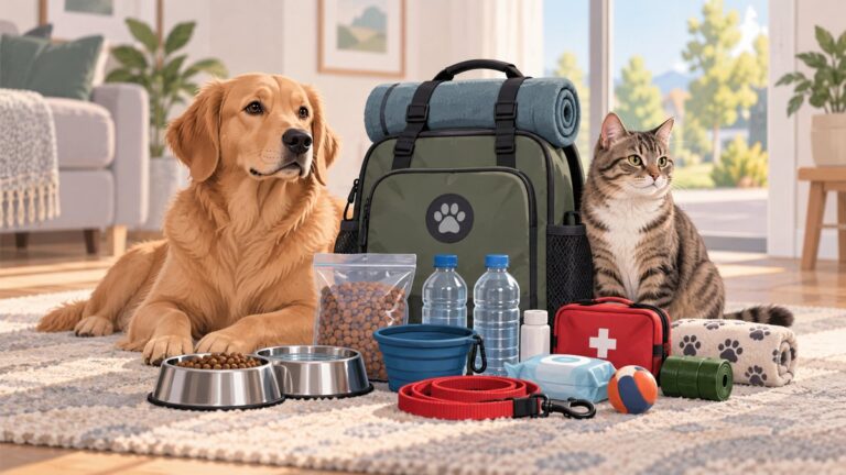
This route can be adapted for a pet-owning traveler, but it is not universally pet-friendly. Wildlife refuges, state parks, visitor buildings, boardwalks, boats, tours, and wildlife facilities can have different rules. Confirm the current policy for each specific trail, unit, facility, and activity before bringing a dog.
- Check access before arrival. A dog permitted outdoors may not be allowed in a visitor center, boardwalk, boat, or wildlife facility.
- Keep dogs leashed where permitted. Chasing can disturb birds, shorebirds, nesting sea turtles, and other wildlife.
- Never allow a pet to approach wildlife. Do not encourage an animal closer for a photograph.
- Plan for heat. A parked vehicle can become dangerous, and hot surfaces can injure paws.
- Carry water and waste bags. Remote areas may lack water, shade, bins, or reliable cell service.
- Choose pet-friendly lodging separately. Confirm accommodation rules directly.
If wildlife viewing is the main purpose of the trip, a dog may be happier during shorter, carefully selected outings than on every refuge drive or boardwalk visit. Respect both the animal’s comfort and habitat rules.
What to pack for the route
Essential road-trip kit
- Water for people and pets, plus refillable bottles
- Sunscreen, insect repellent, a hat, and lightweight protective clothing
- Comfortable walking shoes for sand and damp trails
- Offline maps and a printed map or atlas backup
- Phone charger or power bank
- Small first-aid kit and necessary medications
- Waste bags and a leash if traveling with a dog
Compact birding binoculars are a useful optional convenience for observing distant birds and marsh activity. Choose a pair that is comfortable to hold; binoculars are not required for the trip.
Rank #4

- 🚛【PRE-LOADED North America MapsLifetime Map Updated for Free】7 -inch Navigation Systems has pre-installed with the 2026 latest North America Map, including USA Canada Mexico Maps, which has 2D / 3D map display. If you need to update the latest Map, please contact us to download it. (Downloadable but not pre-installed maps: Europe, UK, Ireland, Australia, and so on)
- 🚛【Vehicle-Specific Routing for All Drivers】7-Inch Large Screen Brings Better Visual Effects, using 3000mah Polymer Battery, 5v 2.5a -350cm Line Car Charger, CPU: Wince Mediatek2531. Built-in 16gb Rom 256mb Ram, Maximum Support 32g Extended Memory, Large Capacity Can Accommodate You Can Store Maps and Materials.
- 🚕【GPS Navigation Helps You Avoid Danger】Car GPS Navigation System has a Voice Steering System (multilingual Version). Receiving Upcoming Sharp Turn Alerts, Speed Limit Reminders and Height Limit Reminders, Red Light, and High-Speed Camera Voice Notification. And Customized truck routing for the size and weight of your truck, avoiding the roads which have width restrictions or height restriction or weight restriction.
- 🚙【Accurate GPS Navigation Signal】 The Truck GPS System is based on offline navigation, which must work based on the active GPS signal. The built-in GPS chip works without a network, so you don't have to rely on your phones and cellular connectivity and the phone is free to use.🚗Note: If the satellite signal can not be searched, it may be because of the reason at home, please search the GPS Navigation signal outdoors again.
- 🚌【7inch GPS Navigator for Car Truck】7-inch, high-resolution touchscreen with a high resolution of 800 x 480 pixels, 16 GB MEMORY 256 MB RAM. The truck GPS navigation system has plenty of room for you to storage the maps and materials, and also comes with Car Charger, USB Cable, Back Bracket, Suction Cup Mount, Sunshade. Even It is Also Clearly Visible in the Sun, High Definition, Making Driving Safer.
If you plan to paddle or take equipment near tidal water, a waterproof phone pouch or small dry bag can help protect navigation information, keys, and a phone from spray. Secure it; waterproof does not necessarily mean it will float if dropped.
Offline navigation and digital preparation
Download maps before leaving Tallahassee or the larger coastal towns. Lower Suwannee may have spotty service, and a refuge road is a poor place to discover that a map application has not saved the area.
Use a printed map as a backup, keep the vehicle fueled, and note the location of your next confirmed stop. A road atlas complements rather than replaces official refuge and park updates about temporary closures and access.
Wildlife ethics: protect the reason you came
The undeveloped shoreline, quiet marsh, and low-traffic refuge road are memorable because they remain habitat. Visitors should:
- Stay on designated trails, roads, and viewing areas.
- Keep a generous distance from wildlife.
- Never feed, chase, corner, touch, or call wildlife closer.
- Follow nesting-area signs and avoid crowding shorebirds or sea turtles.
- Follow posted drone restrictions; drones are prohibited at St. Marks.
- Pack out food scraps, plastic, fishing line, and all trash.
- Do not collect natural features where prohibited.
- Keep noise low and respect other visitors’ experience.
St. George Island’s visitor guidance explains the connection between litter and wildlife harm. The St. Marks refuge information prohibits feeding or disturbing wildlife and collecting natural features. A photograph is the souvenir; leave the habitat where you found it.
Independent reader supportYour contribution helps us test, update, and keep practical guides available for everyone.Planning the trip without rushing it
The five-day version
- Day 1: Tallahassee to St. Marks, with most of the day devoted to refuge roads, ponds, marshes, and the lighthouse.
- Day 2: Wakulla and Panacea units, then continue along the coastal byway toward Carrabelle.
- Day 3: Carrabelle and Apalachicola, followed by St. George Island beach time and an overnight nearby.
- Day 4: Drive toward Cedar Key and explore one access area of Lower Suwannee National Wildlife Refuge.
- Day 5: Crystal River Preserve, then Homosassa, with the option to finish at the wildlife park or stay longer.
This version works best for travelers who accept shorter stops. It is less suitable for serious birders, paddlers, photographers, or families traveling with a dog that needs frequent breaks.
The seven-day version
Add a second night around St. Marks or the eastern Big Bend coast, then another night near Cedar Key, Crystal River, or Homosassa. Extra time leaves room for road closures, weather interruptions, longer wildlife viewing, or a full afternoon on St. George Island.
The Tool Desk
Outbyte Driver Updater FREEFix the driver behind crashes, sound loss and screen glitchesFind Drivers →Outbyte PC Repair FREERepair Windows errors before they cause bigger problemsFix Now →Best Value

- 7” high-resolution navigator includes map updates of North America .Special Feature:Easy-To-Read Display; Voice Assist; Hands-Free Calling; Live Traffic and Weather; Traffic Cams and Parking; Smart Notifications,Driver Alerts; Tripadvisor; National Parks Directory; Find Places by Name; Garmin Real Directions Feature.
- Hands-free calling when paired with your compatible smartphone with BLUETOOTH technology and convenient Garmin voice assist lets you ask for directions to places you want to go
- Road trip–ready features include the HISTORY database of notable sites, a U.S. national parks directory, Tripadvisor traveler ratings and millions of Foursquare POIs
- Driver alerts for things such as school zones, sharp curves and speed changes help encourage safer driving and increase situational awareness
- Access live traffic, fuel prices, parking, weather and smart notifications when you pair this navigator with your compatible smartphone running the Garmin Drive app
For guided experiences, check current safety practices, accessibility, prices, operating dates, cancellation terms, and whether an activity suits your group or pet. At Crystal River, use permitted businesses for water access and confirm current rules with the refuge. No operator can guarantee a particular wildlife sighting.
Final pre-departure checklist
- Verify refuge road and levee closures, prescribed burns, hunting notices, gates, and visitor-center status.
- Verify state-park fees, hours, campground status, tours, launches, and reservations.
- Check the St. George Island campground listing and current overnight arrangements.
- Check Crystal River manatee rules, seasonal information, and permitted tour options.
- Download maps for St. Marks and Lower Suwannee and carry a printed backup.
- Fill the tank before remote refuge roads and do not rely on continuous cell service.
- Pack water, sunscreen, insect repellent, a hat, and weather-appropriate clothing.
- Confirm pet restrictions for each exact trail, facility, boat, tour, and overnight property.
- Keep a flexible schedule for heat, storms, closures, and wildlife behavior.
FAQ
How long should a Big Bend Florida road trip take?
Five days is enough for a fast route from Tallahassee through St. Marks, St. George Island, Lower Suwannee, Crystal River, and Homosassa. Seven days is better for birding, paddling, photography, beach time, and flexibility for weather or wildlife delays.
Is the entire Tallahassee-to-Homosassa route part of the Big Bend Scenic Byway?
No. The byway covers the northern segment through Leon, Wakulla, and Franklin counties and Apalachicola National Forest. Cedar Key, Lower Suwannee, Crystal River, and Homosassa are southern coastal extensions.
Can I bring my dog to Florida’s Big Bend wildlife areas?
Do not assume every stop is pet-friendly. Rules differ among refuge units, park trails, visitor buildings, boardwalks, boats, and wildlife facilities. Check each location’s current policy, leash your dog where permitted, prevent wildlife interactions, and never leave a pet in a parked vehicle.
What is the best season for wildlife viewing?
Fall and winter are a reasonable default for a wildlife-focused trip; St. Marks says hiking is most pleasant in fall, winter, and early spring. Summer remains possible for beaches and paddling but requires planning for heat, insects, and storms.
When can I see manatees near Crystal River?
The U.S. Fish and Wildlife Service lists the refuge’s manatee season as November 15 through March 31. Sightings are not guaranteed. Three Sisters Springs offers land access by shuttle and boardwalk, not water access from that property; check current refuge guidance and use permitted businesses for water access.
The Bottom Line
Make the beaches a reward rather than the starting point. Begin with the marshes and wildlife roads at St. Marks, follow the Gulf coast through Wakulla, Panacea, Carrabelle, and Apalachicola, pause on St. George Island, then finish among the estuaries, springs, and conservation habitats of Cedar Key, Lower Suwannee, Crystal River, and Homosassa. Travel slowly enough to notice wildlife while respecting the rules and habitat that protect it.
Quick Recap
Product prices and availability are accurate as of the date/time indicated and are subject to change. Any price and availability information displayed on Amazon at the time of purchase will apply.