The Tool Desk
Outbyte PC Repair FREERepair Windows errors before they cause bigger problemsFix Now →Outbyte Driver Updater FREEFix the driver behind crashes, sound loss and screen glitchesFind Drivers →Ghost forests are stands of dead or dying coastal trees that mark a shift in conditions—often from freshwater woodland toward salt-tolerant marsh or open water. Documented examples occur around Chesapeake Bay, in coastal North Carolina, on South Carolina’s Capers Island, and in Louisiana’s Mississippi Delta. The available evidence supports these regions and specific locations, but not eight distinct, named forests.
What is a ghost forest?
NOAA defines a ghost forest as “the watery remains of a once verdant woodland.” The name describes the visible dead trunks left behind as a coastal forest declines; it does not mean every dead-tree stand has the same cause or follows the same path. NOAA National Ocean Service


As an Amazon Associate I earn from qualifying purchases.
In many coastal settings, freshwater forest gives way first to patches of salt-tolerant shrubs or herbaceous marsh. If inundation continues, some areas may become open water. The transition varies with local elevation, water conditions, soils and plant species. USGS
What’s actually slowing this PC down?
Pick the symptom - the matching free tool is one click away.
Where are ghost forests in the U.S.?
Published examples are concentrated in the Chesapeake region and coastal North Carolina, with additional documented locations or regional examples in South Carolina and Louisiana. The table distinguishes named sites from broader regions: an agency photograph or regional study is evidence of coastal forest change, not necessarily a separately named forest.
#1 Best Overall

- PRACTICAL: Includes information about basic cuts, skinning, boning, packing and more
- GREAT REFERENCE: A great tool for hunters on how to properly field dress game & avoid any contamination
- WATERPROOF: Don't worry about getting it bloody or wet. Plastic waterproof pages wash off nicely
- WELL ILLUSTRATED: Detailed and well illustrated. Divided into 2 sections: big game & game birds
- EASY TO USE & UNDERSTAND: Perfect for new and experienced hunters
| Place | What the source documents | Evidence and limits |
|---|---|---|
| Mattaponi and Pamunkey rivers, Virginia | Vegetation changes downstream from forest to herbaceous marsh as salinity increases; trees thin and die, leaving standing dead trunks. | USGS reports measurements and sampling at wetland sites along both rivers. USGS, 2021 |
| Chesapeake Bay watershed and Delmarva Peninsula | Coastal forest-to-marsh change is documented across the region, where rising water levels interact with sinking land. | NOAA, USGS and Smithsonian coverage support the regional example; they do not establish one specific stand called “the Chesapeake ghost forest.” NOAA; USGS, 2012; Smithsonian Magazine, 2021 |
| Coastal North Carolina, including the Albemarle-Pamlico region | A study mapped forest conversion to transition ghost forest on unmanaged public land. USGS also summarizes bird-habitat changes in coastal forests in this region. | The study found that 15% (167 km²) of unmanaged public land in its coastal North Carolina study region changed from coastal forest to transition ghost forest between 2001 and 2014. This is a study-area result, not a statewide or national estimate. Smart et al., Environmental Research Letters, 2020; USGS Southeast CASC, 2019 |
| Goose Creek State Park, North Carolina | A freshwater forested wetland is shown transitioning toward open water. | USGS identifies this as a photographed example; the image does not establish a separate named forest. USGS |
| Pamlico River, North Carolina | A Forest Service report shows remnants of trees that once stood along the bank and are now submerged. | This is a documented image location, not evidence for an independently named ghost forest. North Carolina Forest Service, 2025 |
| Capers Island, South Carolina | NOAA captions an image of a ghost forest on the island. | The source documents the island example but does not provide a comparable measurement of its extent or rate of change. NOAA |
| Mississippi Delta, Louisiana | NOAA describes woodlands dying and being buried in open water as water levels rise, the land sinks and sediments compact. | This is a regional example; NOAA does not name a particular stand. NOAA |
How does sea-level rise kill coastal trees?
Rising seas can push saltwater into coastal freshwater systems. Salt-sensitive trees become stressed, lose ground to salt-tolerant vegetation, and may die, leaving snags that make the change visible. Along the Mattaponi and Pamunkey rivers, USGS describes forest thinning and mortality as salinity increases. The agency also reports that freshwater inputs or higher estuarine water levels can temporarily boost growth in surviving trees, but continued salinity increase can overwhelm that resilience. USGS, 2021
Sea-level rise is not the only stressor. High tides, storm surge, subsidence and rising groundwater can also contribute to flooding and tree mortality. In the southern Chesapeake Bay, sinking land and rising water levels combine to produce relative sea-level rise. USGS, 2012
Waterlogged soils create a separate but related problem: saturated soil can deprive roots of oxygen. The North Carolina Forest Service’s 2025 report says groundwater-related tree mortality in the state’s Coastal Plain may be as significant as, or greater than, saltwater intrusion. It maps more than 61,000 acres of forestland affected by sea-level-rise-related factors; that is mapped impacted acreage, not a count of ghost forests. Reported mortality within impacted areas ranges from 1% to more than 50%. North Carolina Forest Service, 2025
What happens to a forest after it becomes a marsh?
A shift from forest to marsh changes habitat rather than simply removing it. Marshes and healthy forests both provide ecological functions, but not the same ones. Bird responses also differ: species associated with understory or standing dead trees may benefit in some settings, while birds that depend on closed-canopy forest can lose habitat. USGS; USGS Southeast CASC, 2019
Rank #3
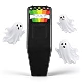
- 【Ghost Hunting Ready】Designed for ghost hunting equipment use, paranormal investigations, haunted house tours and tracking unexplained EMF spikes
- 【Clear 5 LED Scale】Five color-coded LED indicators on this emf reader ghost hunting show milliGauss ranges clearly in bright light or dark spaces
- 【Wide Measuring Range】Detects EMF signals from 50Hz to 20,000Hz and displays field strength from 0 to 20+ mG, with 5% typical accuracy for this ghost detector
- 【Simple Handheld Design】One-button operation, compact hunting equipment body, easy to carry for home checks, office use, or outdoor investigations. Powered by one 9V battery for ready-to-use convenience
- 【Find Everyday EMF Sources】Identify magnetic field changes around TVs, computers, microwaves, refrigerators, wiring, and power lines. Can register nearby mobile phones within about 2 ft under typical conditions
The North Carolina study estimated a net aboveground carbon decline of 0.13 ± 0.01 TgC associated with forest-to-transition-ghost-forest conversion in its study region and period. That figure concerns aboveground carbon in the study area—not all carbon, all coastal forests, or a national total. Smart et al., Environmental Research Letters, 2020
Independent reader supportYour contribution helps us test, update, and keep practical guides available for everyone.Why the U.S. list is not eight named forests
The sources establish several affected regions and a handful of named locations, but they do not verify eight distinct named forests. Some entries in popular lists may refer to broad watersheds, photographed sites or study regions rather than individual forests. Treating those as eight equivalent sites would imply a level of site-specific documentation the available sources do not provide.
Quick Recap
Best Value
Product prices and availability are accurate as of the date/time indicated and are subject to change. Any price and availability information displayed on Amazon at the time of purchase will apply.
Recommended Free Tools